
Description
VERKOOP BIJ INSCHRIJVING
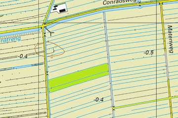
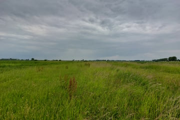
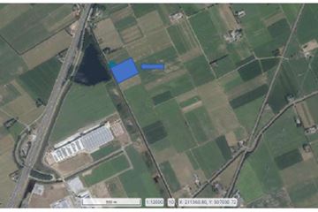
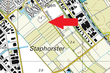
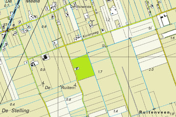
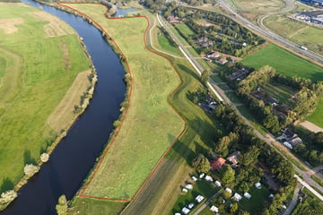
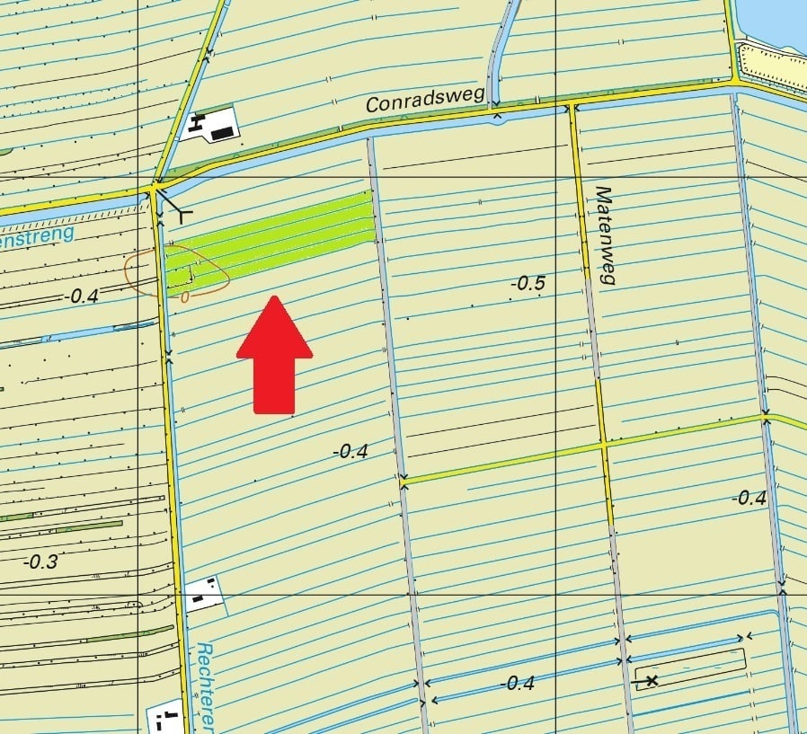
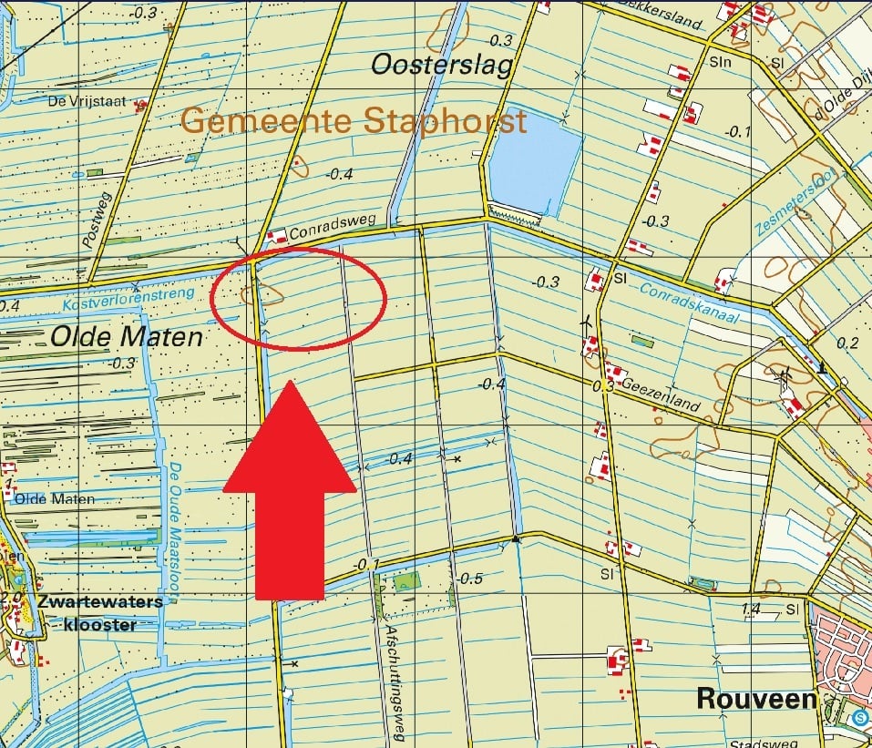
Omschrijving: Percelen cultuurgrond gelegen aan de Rechterensweg te Rouveen;
Oppervlakte: 06.19.10 ha;
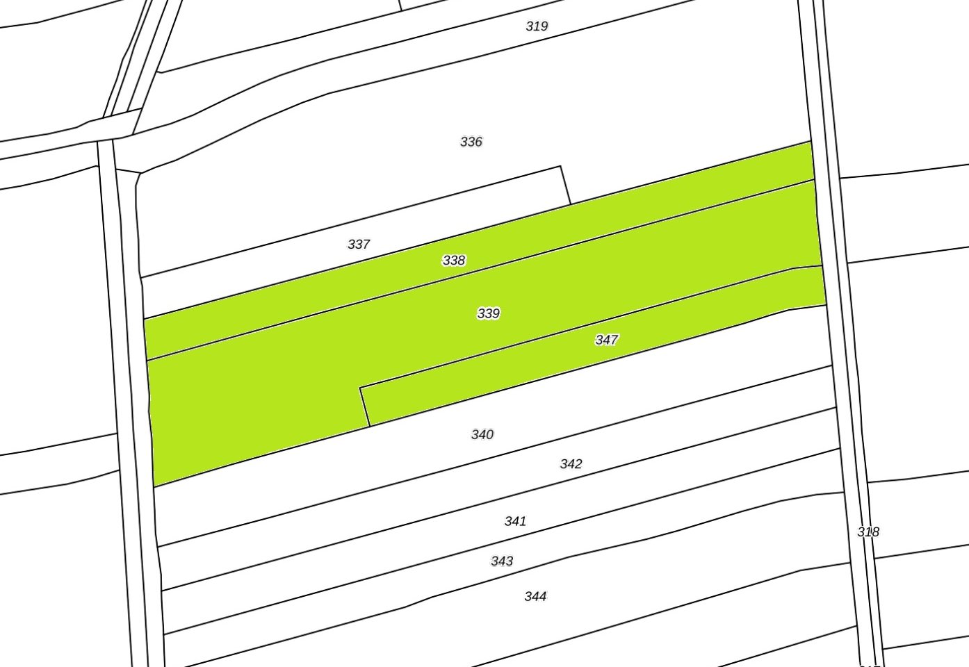
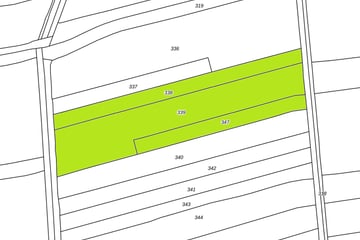
Kadastrale aanduiding:
Gemeente Staphorst, sectie AM, nummer 338, groot 01 ha 50 are 70 ca;
Gemeente Staphorst, sectie AM, nummer 339, groot 03 ha 62 are 85 ca;
Gemeente Staphorst, sectie AM, nummer 347, groot 01 ha 05 are 55 ca;
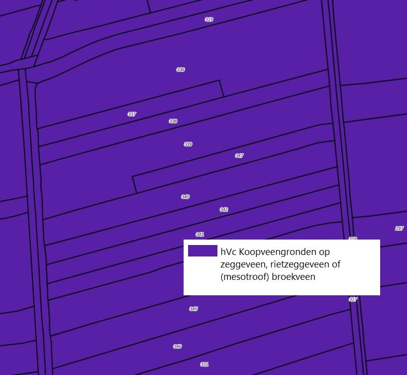
Bodem: Koopveengronden op zeggeveen, rietzeggeveen of (mesotroof) broekveen;
Ruilverkaveling: Niet van toepassing;
Productierechten: Niet van toepassing;
Uitbetalingsrechten: Niet van toepassing;
Natura2000: Nabij het gebied Olde Maten & Veerslootslanden gelegen. Valt niet binnen Natura 2000 maar wel binnen de grenzen van Agrarisch Natuurcollectief: Coöperatieve Agrarische Natuur Collectief Noordwest Overijssel U.A.
Onderdeel van volgende leefgebieden: K01 Klimaatbeheer en A11 Open grasland;
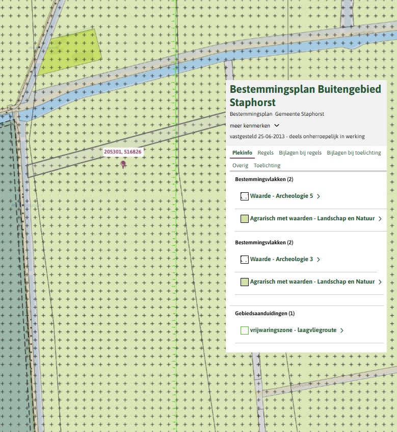
Bestemmingsplan: Enkelbestemming Agrarisch met waarden – Landschap en Natuur, Waarde – Archeologie 3 en 5 en gebiedsaanduiding vrijwaringszone – laagvliegroute;
Uiterste biedingsdatum: 26 februari 2025 - 12.00 uur
Stukken zijn op te vragen bij ons kantoor.
Omschrijving: Percelen cultuurgrond gelegen aan de Rechterensweg te Rouveen;
Oppervlakte: 06.19.10 ha;
Kadastrale aanduiding:
Gemeente Staphorst, sectie AM, nummer 338, groot 01 ha 50 are 70 ca;
Gemeente Staphorst, sectie AM, nummer 339, groot 03 ha 62 are 85 ca;
Gemeente Staphorst, sectie AM, nummer 347, groot 01 ha 05 are 55 ca;
Bodem: Koopveengronden op zeggeveen, rietzeggeveen of (mesotroof) broekveen;
Ruilverkaveling: Niet van toepassing;
Productierechten: Niet van toepassing;
Uitbetalingsrechten: Niet van toepassing;
Natura2000: Nabij het gebied Olde Maten & Veerslootslanden gelegen. Valt niet binnen Natura 2000 maar wel binnen de grenzen van Agrarisch Natuurcollectief: Coöperatieve Agrarische Natuur Collectief Noordwest Overijssel U.A.
Onderdeel van volgende leefgebieden: K01 Klimaatbeheer en A11 Open grasland;
Bestemmingsplan: Enkelbestemming Agrarisch met waarden – Landschap en Natuur, Waarde – Archeologie 3 en 5 en gebiedsaanduiding vrijwaringszone – laagvliegroute;
Uiterste biedingsdatum: 26 februari 2025 - 12.00 uur
Stukken zijn op te vragen bij ons kantoor.
Map
Map is loading...

Cadastral boundaries
Buildings
Travel time
Gain insight into the reachability of this object, for instance from a public transport station or a home address.